Opening Statement

I went to the woods because I wished to live deliberately, to front only the essential facts of life, and see if I could not learn what it had to teach
~Henry David Thoreau, Walden


Wednesday, December 6, 2017

Snow Mountain Wilderness, Mendocino National Forest - December 2-4, 2017

Snow Mountain is just a 3.5 hour drive north of San Francisco, but hasn't really become well known yet, despite being established in 1984.  I love it's other-wordly landscape and feeling of solitude, at least in the off season.

I'm trying out a bit of new gear, including my new smartphone and video editing software, so I made a short video of the trip that gives you a good sense of the terrain.


As you can see in the video, we got a bit of snow, and the weather was cold, but it was delightful to be up in the mountains, and even more beautiful because of all the snow and ice formations. 

Friday, September 15, 2017

PCT 20 - 2017 Wrap Up


This year I retired on March 1st, then started on the PCT April 2nd.  I hiked two thousand miles on the PCT, three-quarters of the trail.  This is more backpacking than I had done previously in my life.  In this post, I'll share some of my reflections on hiking the trail.

But first, I picked out some of my favorite pictures and put them in slide shows of about a minute and a half each:

  Campo to Kennedy Meadows (California South)
  Quincy / LaPorte Rd. to Oregon Border (California North)
  Oregon Border to Santiam Pass (Oregon)
  Cascade Locks to Canada (Washington)

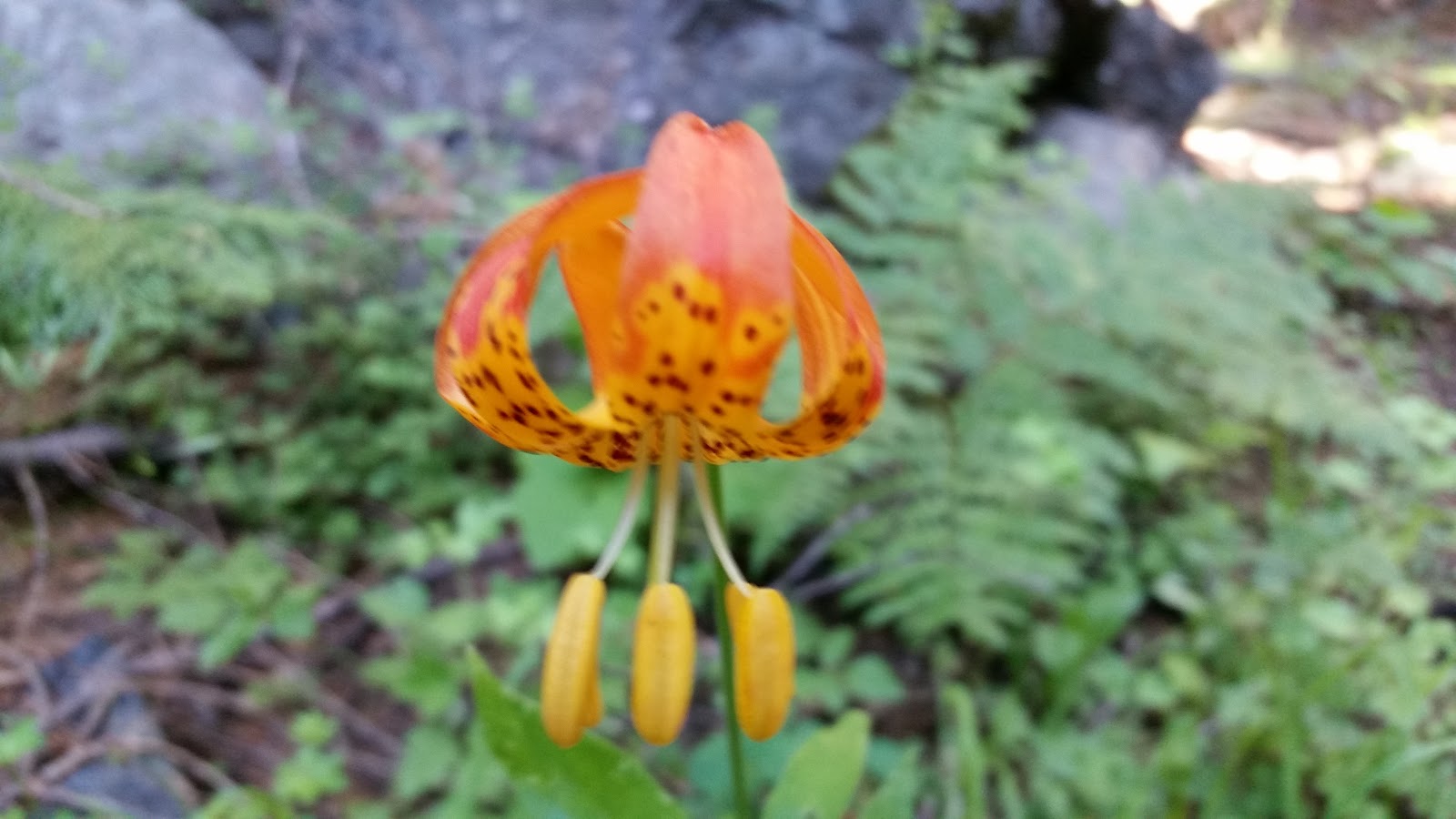
The Pacific Crest Trail
The trail itself is one of the best built and maintained trails anywhere.  It's hard even to imagine the amount of effort that volunteers, the Forest Service, the Park Service, and others put into the trail each year to keep it so easy to hike.  The quality of the trail makes a huge difference in speed and effort when hiking long miles.

As my trail hobby and contribution to maintaining the trail, I did an "obstruction survey" for the Pacific Crest Trail Association, using the GPS on my phone to note the mileage point of over 1,000 downed trees during 1,800 miles of my hike.  The list of obstructions was used by trail crews to help plan and prioritize removal projects.

Experience vs. Achievement
In a long-distance hike of the PCT you spend months living out of a backpack, your life becomes very simple, and you get in-tune with nature.  You are doing something you enjoy and have chosen yourself; for most people it's a magical experience and memorable time.

Hiking a long distance can also be thought of as some kind of athletic achievement, but it's probably better not to dwell on that too much.  After all, so many other things in life require more than five months of focus and effort.  I met one hiker who said that he thought people hiked the PCT for "the glory" of finishing the trail.  That did not ring true to me.

Deep thoughts
I was genuinely surprised by how physical the experience was for me, and how few "deep thoughts" I had while on trail.  When out hiking for a week or weekend, there is plenty to think about from your ordinary life.  Hiking for months at a time, mostly I was just thinking about hiking and enjoying nature.  Before getting on trail someone said to me "It's more of a mental challenge than a physical challenge."  That did not seem at all descriptive to me of the experience.

People
You naturally have a lot in common superficially with others hiking the trail.  This makes it easy to strike up casual friendships.  Also there is an unwritten "no whining" rule on the trail, which is probably the best part of trail culture.  I enjoyed the social aspects of the trail and will probably keep up with a few of the people that I met.  "Trail angels" also add a lot to the trail by providing an unexpected cold drink or ride into town.  Other than their interest in hiking, and ability to take several months off from their ordinary life, people hiking the trail seemed pretty ordinary or average to me.

Light and Ultralight Gear
Many hikers use "light" or "ultralight" gear on the PCT.  This makes sense as PCT hikers are unlikely to run into extended spells of snow or freezing rain as long as they start in April and finish by the end of September.  My "base weight" was about 25 pounds, which is heavy for the PCT.  I would like to reduce this for my next hike.  Carrying less weight translates into faster hiking speeds, which means more miles covered in a day (or more time watching the sunset).

Health and Pain
Almost everyone loses weight on a long hike.  I lost 25 pounds (yikes!), and also brought my cholesterol within the normal range.  Maintaining those benefits will be another challenge.

A large percentage of hikers have some pain from over-use injuries.  With arthritis in both knees, I anticipated some difficulties.  After 500 miles of hiking, I had to take eighteen days off to rest my right knee, after which my knees were "OK" for the rest of the hike.  My left foot developed pain that almost took me off the trail, probably from Morton's Neuroma.  I was finally able to get some relief with Moleskin foam, but still had a sore foot for about 700 miles.

Danger
A lot of people worry about dangers on the trail; however the trail is relatively safe most years.  My own hike was uneventful.  Here's a perspective on a short list of dangers:

Giardia - A few people get giardia every year because they didn't filter their water.  Probably 80+ percent of hikers are very careful to filter all their water.
Insect bites - Everyone gets bitten by mosquitoes, and a few people by bees or wasps.
Falls - A few percent of hikers have falls that cause some injury, usually scrapes or sprains.  Deaths of long-distance hikers due to falls are very rare, but can happen.  One PCT hiker died from a fall this year, and a few other hikers died from falls near the PCT.  Steep snow can be a little scary.
Drowning - Due to the high snow levels this year, two PCT hikers drowned in the Sierras.  This is unusual and was probably preventable; however, a lot of people had close calls this year.  Several non-PCT hikers drowned near the PCT this year.
Getting Lost - The PCT is such a major trail, that there are only a few situations when you will be off trail, such as hiking over snow.  Still, getting lost is probably the biggest single cause of back-country tragedy, so it's important to stay aware of where you are.
Hyper and hypothermia - These are almost always the result of poor judgement and/or inadequate gear.  One PCT hiker died this year related to overheating, and there were several rescues due to hypothermia or the risk of it.
Bears and Mountain Lions - Kind of like a shark attack, very high fear factor, but very low incidence.  No cases this year that I heard of.  I only saw bears once.
Snakes - I saw over a dozen rattlesnakes, but there wasn't really any danger from them as long as you didn't get too close.
People - Since hikers are carrying over $1,000 in gear, and some cash, you might expect more robberies and thefts.  This turns out to be very rare.

Conditioning
Coming from a sedentary job and just a moderate exercise regimen, I found that my personal fitness level improved every week that I was hiking, right until the end.  At 61 years old, it would have been much better if I had spent more time conditioning myself before starting.  The popular idea that you can get conditioned while on trail is more accurate for people under 40, who will find that their body responds faster.

Section-hiking vs. Thru-hiking
In an average year, perhaps fifteen percent of PCT hikers with a thru-hiking (entire trail) permit actually are able to finish the whole trail.  This year, due to the high snow in the Sierras, and the many fire closures, very few hikers will complete the entire trail in 2017.  I'm happy and satisfied to have completed three quarters of the trail and it has made me think about whether thru-hiking is really the best goal to have.  Personally, I now think that doing the trail over two years makes more sense for people who have that flexibility.  The short weather window makes a thru-hike very difficult to achieve on the PCT for all but the fastest hikers, and pushes other hikers into hiking later into the fall than they might want to, or trying to push into the Sierras before the streams have gone down to safe levels.  Also, fire closures (like we had this year) can prevent a thru-hike even for the fastest, most-aggressive hikers, so fixating on achieving a thru-hike can be frustrating for that reason as well.


Next year I hope to hike 650 miles to have completed the entire trail.

Tuesday, September 12, 2017

PCT 19 - Final Push - Rainy Pass to Manning Park - 69 PCT miles


2,000 miles into my hike, the last mile felt like any other.  As I came down the trail, I saw the large sign for Manning Park Canada, stepped up onto the roadway, and that suddenly my PCT hike was finished for 2017.  Probably it will take a few days to sink in.

This last 69 mile stretch was extremely scenic, with long open mountain vistas, a famous traverse showing off fall colors, beautiful streams, and low clouds in fascinating shapes.

After our friends Penelope and Monte generously ferried us to the trailhead we started our final section into Canada.  The first day my hiking partner Robert and I staggered up into a mixture of smoke and clouds, but by mid-afternoon we were treated to blue sky in patches and clearing smoke due to a change in the wind.   The second day we had good visibility, but also a light rain for five hours, which ended about six in the evening.   We pitched our tents about 20 miles from Monument 78 at the border with Canada.  Also at our campsite we met Jan and Nancy, two former NOLS instructors, who we enjoyed chatting with.  The third day we had beautiful scenery, but might have been rushing through it just a little in our eagerness to reach the border.  Finally at the monument we took pictures and then crossed over into Canada, setting up camp just over the border, just 8 miles from Manning Park.  A few other hikers camped with us, including a semi-famous hiker named Optimistic Turtle, who writes a popular blog about her PCT hike.

At the Monument there is a book for comments, and I snapped pictures of my own comment and quite a few pages of comments from other hikers.  You will see those in the album for this section.

The Manning Park Lodge gave us free showers and let us use their coin-operated guest laundry, so we were able to clean up.  The Greyhound Bus left Manning Park at 2 am, bound for Vancouver.  From there I will catch a flight onward to San Francisco.   Needless to say, I am looking forward to seeing my family after two and a half months away.

Thank you to all the people who have followed my blog, and especially those of you who have made comments.   Connectivity has been pretty spotty, so I couldn't keep up a dialogue, but I did appreciate and enjoy the comments.

Sometime soon I will write a wrap-up post, for my hike, so if you have questions feel free to let me know.  Otherwise you will just have my personal reflections.

Here is a link to the photos for this section:
https://photos.app.goo.gl/nmYcYYvjnYu5xofD2

Thursday, September 7, 2017

PCT 18 - Yo-yo Climbing - Stevens Pass to Rainy Pass - 127 PCT miles


This is really two sections:  Stevens Pass to Stehekin of 107 miles, and then just 20 miles onward to Rainy Pass.

The first 107 miles was the most difficult section that I have hiked on this trip.  We went up and down several ridges, getting to see spectacular views from the ridges, and finding great campsites and water in the valleys.  Here are my notes showing the mile points, the distances traveled, and feet of climbing between campsites/trailheads.

2461.74 Stevens Pass trailhead
... 16.98 mi, 3970 ft
2478.72 small campsite
... 20.77 mi, 5659 ft
2499.50 Foam Creek trail junction
... 18.76 mi, 5510 ft
2518.26 Mica lake
... 22.03 mi, 5751 ft
2540.29 small campsite
... 20.97 mi, 4844 ft
2561.26 Swamp Creek
... 8.17 mi, 965 ft
2569.12 High Bridge Ranger Station at Stehekin

We were lucky to just have a small amount of smoke during most of the hike, but it really rolled in once we made it to Stehekin.   It seems like the forests are on fire all around us, and we are just lucky that the PCT is still open in the section we are hiking.  I just have four more days of hiking to make it to Canada, so I am crossing my fingers that I can make it through. 

To my surprise, I ran into several hikers that I had not seen since California,  including Robert, Gourmet/Sarah, Jim and Jodie, and another hiker that I had not seen since southern Oregon, named Megaphone, and a couple from Oakland named Jeff and Meg that I last saw in Etna.  Gary Pegg also passed us on the trail with his horses; I saw him last in Goat Rocks.  Everyone is worried that the trail may close due to fire danger, but we are OK so far.

Once we arrived in Stehekin, Robert and I shared a room at The Ranch for two nights to rest our feet and recharge with great food from their kitchen and the Stehekin Bakery, which lived up to it's reputation for amazing pies.  

Hiking on to Rainy Pass, we were enveloped in smoke.  I had called ahead to friends Penelope and Monte, who picked me and Robert up at the trailhead and brought us to Penelope's ranch in Twisp for dinner and a chance to clean up again.  It's a great treat, and I am writing this from a spare bedroom at the ranch before dinner.

Tomorrow Robert and I will get back on trail for the last 69 miles of hiking into Canada.  

Here is a link to the photos for this section:  https://photos.app.goo.gl/ZWQkeNnApFo8SkeP2 


Monday, August 28, 2017

PCT 17 - Smoke and Poetry - Snoqualmie Pass to Stevens Pass - 71 PCT miles


This short section introduces northbound hikers to the ups and downs of the northern Cascades.  We climbed and decended over 17,000 feet, which made for long strenuous days.

The scenery was classic mountain ridges and beautiful lakes, although many of the longer views were obscured by the active forest fires.   All of the trails east of the PCT were closed due to the fire and the smoke was thick enough to make my eyes smart at times.  On the plus side, this usually-busy section didn't have crowds, even though I hiked through on the weekend.

An unexpected highlight of this section for me was running into Mr. Whiskers, who was hiking southbound.  Something possessed me to ask if he was a poet and he proceeded to recite with great expression "If" by Rudyard Kipling, as well as Invictus and Ozymandias.  It was a remarkable treat.

Also in this section, I ran into Lori and her husband Bill.  Lori and I had hiked together for a few days in April near Tehachapi.  They were section hiking southbound and I stayed with them two nights after reaching Stevens Pass, enjoying their hospitality, which included fresh blackberry cobbler.

For two and a half days I hiked with Greg, aka Half Squat, which was a nice variation on my usual solo hiking.  Half Squat had balanced being a commercial airline pilot and single dad, resulting in an unperturbable attitude.

For those of you following my foot challenges, I did get some relief using moleskin foam, and will try that again in the next section.

The upcoming section feels a little outside of my comfort zone.   107 miles with more than 25,000 feet of climbing.  I'm giving myself 5.5 days, which is my longest stretch so far.

Here is a link to the photo album for this section:  https://goo.gl/photos/NFNzyUK453VLNnj78

Thursday, August 24, 2017

PCT 16 - Knife and Goat - Trout Lake to Snoqualmie Pass - 164 PCT miles


Hiking the "knife's edge" and surrounding trail was one of the few times on this trip that I have felt the absolute necessity of taking care with each foot placement.  The long drop off, steep trail, and loose gravel kept my full attention.  At the same time, whenever there was a flat spot, I had to marvel at the view of Mount Rainier and the closer mountains.  The Goat Rocks Wilderness between Trout Lake and White Pass was dramatic and satisfying.

Coming out of Trout Lake, the PCT skirts one side of Mount Adams, which is a popular destination both for the surrounding wilderness and as a summit challenge.  As the trail progresses there are some distant views of Mount St. Helens.  Eventually the trail transitions over to views of Mount Rainier and the rugged Goat Rocks Wilderness.   While the most dramatic section is only about 14 miles, it was so stunning that I can easily see why so many people make a special trip to hike it.  In this section I also met Gary Pegg who is attempting an equestrian thru hike - see www.garypegg.com

After White Pass the trail mostly kept to the forests, with occasional vistas.  On August 21st I ran into some day hikers who had a spare set of eclipse glasses, so I took an hour out to enjoy the 90 percent eclipse that we had.  The highlight of the next day was having dinner at a PCTA trail camp, and chatting with the volunteers.  Also during this section the trail ran just outside the closure line for several active forest fires.  I could both see and smell the smoke, but the fire wasn't too close.

As the miles tick by, I am looking forward both to attacking the most remote section of the PCT, and to reaching Canada, now less than 300 miles away.  Foot pain continues to be my major difficulty, and I will be trying some moleskin foam to see if that helps. For the time being, I'm still hiking!

Here is a link to the photo album for this section:  https://goo.gl/photos/6pVYuuaDMFMCGCyB8

Tuesday, August 15, 2017

PCT 15 - Soaked Forest - Bridge of the Gods to Trout Lake - 82 PCT miles


The name "Bridge of the Gods" evokes an extravagant grandeur unearned by the simple truss bridge over the Columbia River that takes hikers and other traffic from Oregon to Washington, but the river gorge itself is majestic and breathtaking.

Climbing from the low point of the PCT at Cascade Locks, the trail quickly climbs into a mixed evergreen forest with a tangled understory including ferns and matted moss covering both trees and rocks.  Only frequent mists and rain produce this kind of vegetation, so it was little surprise when the second evening brought a soaking mist and intermittent light rain that lasted about 36 hours.

Having refreshed my gear in Portland, where I stayed four days with friends, I was hoping to charge up into the mountains with fresh enthusiasm.  In all honesty this section found me struggling to get excited about being back on trail.  Knee and foot pain, combined with simple fatigue and missing my family have been taking a toll.  I  know this happens to a lot of hikers at some point, so I am taking a day off at Trout Lake to rest before going on.  The next section will take me through the Goat Rocks, which are famous for their beauty, so I am looking forward to hiking that section.

The trail continues to be calm and beautiful as you can see in the small photo set here:
https://goo.gl/photos/DShrDvQZzqECs9kd8


Tuesday, August 8, 2017

PCT 14 - From Green to Black - Callahan's to Santiam Pass - 283 PCT miles


Finally I could upload my photos, so this is a catch-up post for over two weeks of hiking.

Southern Oregon is aptly called the Green Tunnel, as the trail winds through mile after mile of forest.  The scenery changes little from one mile to the next and even from one day to the next.  Thank goodness for audiobooks!  As I walked through the forest, I also worked my way through the last few books of the Harry Potter series, which was a fantastic treat.  Although the scenery changed little inside the Green Tunnel, the forests and lakes have a calming beauty, and walking that trail is meditative and certainly worth every step of the journey.

As I worked my way north, the trail goes through a large area of volcanic activity, including Crater Lake, the Three Sisters Wilderness, and the Obsidian Limited Entry area.  As you will see from the photos, the trail passes through beautiful mountain valleys, past small mirror-smooth lakes, and also through unbelievably desolate lava fields.  A forest fire nearby Crater Lake threw up a smoke plume and made everything hazy in that section.  A few days after I passed through that area, the trail near Crater Lake was closed due to the fire.

My hiking pace continues at 20 to 24 miles on an average day, with a penalty of 6 to 10 miles when I make a town stop to resupply.  At this point in the trail, probably 80+% of the hikers are in their 20's and 30's, with hikers over 50 representing only about 10%.  The younger hikers are mostly hiking longer miles each day, but also taking longer town stops, so I've still been meeting a lot of the same hikers day by day.

My knees continue to bother me from time to time, and I've felt that a few days off would help.  On August 7th one of my friends picked me up at Santiam Pass, and I am currently spending a few days in Portland before getting back on the trail.  While most of my gear is holding up, my clothes, boots, and backpack need to be replaced while I'm in town.

The trail north of Santiam Pass is closed due to a forest fire, so I have to skip ahead to continue my hike.  I'll let you know where I got back on trail in my next post.

Here is a link to the photos for this section:  https://goo.gl/photos/oXS4fC7GxUsCsTir9

Monday, July 24, 2017

PCT 13 - Oregon Ho! - Seiad Valley to Callahan's - 63 PCT miles


The climb out of Seiad Valley is steep, with about 4,000 feet of elevation gained in the first 10 miles.  The main consolation to all this climbing comes in the form of cooler weather as the elevation increases.  The weather was so hot in Seiad Valley that I waited until 4 pm to get back on trail, and just hiked up over 4 miles before camping in a tiny flat spot that was advertised as having room for three tents, which seemed to me a very generous estimate.

The trail was surprisingly empty as some hikers had found rides past the main climb, skipping about a day of tough hiking.  While this type of skip doesn't appeal to me, it's fairly common as a way to speed up a long hike without really missing the most dramatic parts of the trail.  In the end everyone has the experience that they chose; there aren't really any rules about how to do the hike.

The main drama of this section was crossing over from California to Oregon.   In a way this sounds like an arbitrary shift, but on the ground there really is a change with more water, greener forests, and smoother trails.

Right now I'm luxuriating in the comfort of the dining room at Callahan's,  which is a hotel near the PCT and also close to Ashland.  Life is good.  I'm going to pitch my tent on their back lawn and get back on trail first thing in the morning.  

Here are the photos for this section:  https://photos.app.goo.gl/aFGkb7tghCyBNtwr1

Friday, July 21, 2017

PCT 12 - Starched Shirt - Etna to Seiad Valley - 56 PCT miles


By the time I had reached Etna, my hiking shirt was completely worn through at the middle of my back.  Luckily there was a thrift shop in town, and I was able to pick up a long sleeve dress shirt to hike in.  The shirt was still starched from the laundry, and I looked quite formal as I trundled down the trail.

There was a forest fire burning a few miles from the PCT, so there were some ghostly scenes of the smoke wending it's way between the mountains.  

This section went through the Marble Mountain Wilderness,  named after a very unusual mountain, which I am guessing has a lot of marble in it.  Most of the rock was granite with some large quartz inclusions, which is unusual.

During this section it occurred to me that this type of hiking has a different quality from more casual hiking.  Your own life and the hike become one thing.  The rhythm of your day and the rhythm of the hike can't be separated.   This isn't very easy to explain, but it's very easy to experience.

I will hike into Oregon in the next section!

Here are the photos for this section https://photos.app.goo.gl/4Do8Wd2sfDB2ad5E2

Monday, July 17, 2017

PCT 11 - Low Mountain Ranges - Castella to Etna - 98 PCT miles


Crossing Interstate 5, the PCT climbs from Castella at just under 2,000 feet to a high traverse of the Trinity Alps and Russian Wilderness areas.  While the trail mostly stays between 5,000 and 7,000 feet, the mountains except for Lassen and Shasta are only slightly higher.  In a sense these are low mountains, but have much of the drama that we find in the high Sierra.

I left Castella at about 5:30 in the afternoon,  just hiking up away from the Interstate to a beautiful stream crossing where I made camp with a few other hikers.  The next day was demanding, with over 6,000 feet of climbing over 24 miles.  The day after the trail was much flatter, making for faster hiking, and I logged 27 miles, my longest day so far.  These big days put me ahead of my hiking schedule,  but also tired me out.  The next two days I was slower and finally getting to the Etna Summit trailhead was a relief.

In this section I enjoyed hiking along with 8 other hikers who were hiking similar miles per day, although all at a faster pace than I  hike.  Grim, Akuna, Mello, and Rubber Ball gave me the trail name Lickity Split  because I take short breaks, and then I am gone down the trail.  Grim also noted that there is also a reverse meaning in it since my hiking pace is so slow.  Sort of like calling a really tall person "Tiny."  If this makes no sense to you, you have not yet internalized the random logic of trail names.  Spatula,  Lucky Charms, and Bang Bang thought "The Nutty Professor " would be a good fit because of my squirrel puppet, which is another good opportunity for a leap of logic.  For the moment, I am going with Lickity Split.

Etna is one of those extremely small towns that still manages to have everything a hiker needs.  Thus includes a good burger shack, and a hiker-friendly B&B with one side of the property called the hiker hut.  The hiker hut has a shower, laundry, common room, WiFi,  and an area to pitch tents.  Oh and did I mention a brewery?   Not essential,  but Etna has it's own too.

I will likely take a rest day tomorrow to recharge, and be back hiking on Wednesday.

Photos for this section are here:  https://photos.app.goo.gl/EcUAmPQQsGFozip53

Wednesday, July 12, 2017

PCT 10 - Forest in Earnest - Burney to Castella - 89 PCT miles


From Burney the trail entered the forest, with occasional glimpses through the trees of Mt. Lassen, then Mt. Shasta and eventually Castle Crags.

This was a section with a lot of ups and downs, with one day including over 6,000 feet of climbing, but also with a lot of shade to moderate the summer heat.  I found myself doing slightly over 20 mile days, which is about the pace that I want to be on right now.

One of my daughters asked what I think about while hiking, and I'm afraid that the answer isn't impressive.   Basically I'm just experiencing the trail and being in nature.  Few deep thoughts are racing through my mind.  I generally hike without listening to anything in the morning,  and listen to audio books, podcasts, or music for a few hours in the afternoon.  I finished Harry Potter and the Goblet of Fire in this section.  After I make camp, I might read a bit, but I  usually go to sleep after a few pages.

There are still a lot of wonderful wildflowers, and it's nice to see some of the same people at breaks who are hiking at about the same pace that I am.

Here are the photos for this section.
https://photos.app.goo.gl/eiJg5vlrvJCxIe2v2

Also, I was able to post the photos for the previous section and have updated that entry with a link to them.

Saturday, July 8, 2017

PCT 9 - Snow Melt Blooms - Quincy / LaPorte Road to Burney - 175 PCT miles


Back on trail after a short visit home.  Due to continuing high snow in the Sierras, most thru hikers had to skip north, at least temporarily.   After finishing the desert section, I got back on trail at the Quincy / LaPorte road, which allowed me to bypass all but about 1/2 mile of snow hiking.

Although I didn't plan it this way, my timing also put me on trail right after the snow melt.  So, I was treated to an explosion of wildflowers similar to the superbloom in the desert.  It was fantastic summer hiking with warm to hot days and mild nights.

Hiking this section, it's striking both how clear the air is, and how slow the Internet is when you can get any connection at all.  This is my first hike where electronics were important, and it's strange to have to have to juggle charging devices and finding a network occasionally with the much more primal aspects of hiking.

Notable this section:

Since I'm now hiking north, I'm in a small "bubble" of other hikers travelling at about the same speed, which makes for a more social experience.

I listened to the first Harry Potter book, and was instantly hooked.

The streams in the Lassen National Forest were full and cascading down waterfalls.  I had to wade across one after searching and not finding any dry crossing.

Hiking through Lassen National Park included walking over a lot of old lava, and the scenery was beautiful.

I ran into my trail friend Trek Ever, and we had a good visit.

Here are the pictures for this section.
 https://photos.app.goo.gl/8fvjAQ0C53UjA1Al1

Monday, June 19, 2017

PCT 8 - Cruising and Climbing - Big Bear to Idyllwild - 87 PCT miles

Coon Creek Historic Cabins

This was the section where I finally felt like my "hiking legs" had returned, bringing to mind a quotation from "Zen Mind, Beginner's Mind," "just like thread unwinding from a spool, I want the past to become present."  In a sense, this is a hike backward through time, as day by day I hike off accumulated stress (and fat) and my fitness returns to a level that I once could take almost for granted.  Right now my fitness is similar to what I remember in my 40's.  That works out to about one year for every 50 miles hiked, so at that rate I'll have the energy of a two year old by the end of the summer.

View from the Top of Mt. San Jacinto

The big event of this section was the climb from my camp spot in the desert at the base of Mt. San Jacinto at an elevation of 1,730 feet to the peak of Mt. San Jacinto at an elevation of 10,833 feet.  Worrying that I might get caught in the heat, I started the climb at 5 AM, carrying five liters of water against a 20 mile stretch to the next reliable water source.  My timing was good since by the time the day got hot on the desert floor, I was already above 5,000 feet and enjoying cooler weather.  I camped at 8,350 feet, for a net increase of 6,620 feet that day, and hiked on to the summit the next morning.  For comparison, the Bright Angel trail from the South Rim of the Grand Canyon to the Colorado river has an elevation change of 4,380, so my first-day climb covered over 50% more elevation increase.  I was tired, but felt satisfied that I could cover that much elevation in a day.

Cool Weather Again up on Mt. San Jacinto

My first night into this section I made it to the Coon Creek historic cabins and was the sole visitor that night.  The San Gorgonio Wilderness was very beautiful and still had plenty of water, making it even more enjoyable.  It was also interesting to pass by the exotic animal cages of the Predators in Action company, although a bit sad as well since these animals have limited space to live in.

With my hike down Devil's Slide trail into Idyllwild, I've now completed the trail between Campo at the Mexican Border and the Kennedy Meadows Campground at mile 704.  I saw very few Northbound hikers in the last few days, and was also the only camper at the State Park campground in Idyllwild.  A friend that lives nearby came to Idyllwild to pick me up, and I went back home via Amtrak.

My plan is to get back on trail at mile 1232.33, which means temporarily skipping over the Sierras and hiking at lower elevations for awhile due to the snow.

Here's a link to the photos for this section:  https://goo.gl/photos/5kdCVMbTYonojwe9A

Wednesday, June 7, 2017

PCT 7 - Baking and Soaking - Cajon Junction to Big Bear -76 PCT miles


Deep Creek Hot Spring

Hiking into the deep creek drainage, the trail has little shade, and many hikers try to find an overhanging boulder to wait out the hottest hours of the day.  Even though I knew it was close, there was an exotic and fantastical transition as the trail dipped down to the water and surrounding  shade from nearby trees.  It felt like a different reality.  I stripped down and both swam in the river and joined the bathers for a few minutes in one of the hot pools.

This 76 mile section was my return to the trail after an 18 day rest due to knee pain.  I was eager to be back on trail, and found the miles easier than expected.  Although this section was hot, there was also relatively good access to water, so it wasn't as difficult as some parts of the Mojave.

Hiking Southbound has opened a window into the different types of hikers on the trail.  When I was near Kennedy Meadows, I met some of the fastest and fittest hikers on the trail, while now it's more of an average group, with even a few slow hikers thrown into the mix.

Since I stopped carrying a dedicated camera, these pictures are all from my smartphone :  https://goo.gl/photos/wRy2uPF1NSR78mn96

Saturday, June 3, 2017

PCT 6.1 - Back to the trail!

After two weeks off trail my knee started to feel much better, and I booked an Amtrak ticket to Victorville, just 18 miles from where the Pacific Crest Trail crosses I-15 near Cajon Pass.  I'm enjoying a rumbling ride on the rails right now.  Tomorrow I should be back on the PCT.  If all goes well, my next update will be five days later from Big Bear Lake.

Thanks for the moral support.   I appreciated the messages and encouragement.

Thursday, May 18, 2017

PCT 6 - Wobbling and Preservation - Wrightwood to Cajon Pass - 27 PCT miles

Falling Snow Climbing out of Wrightwood

Leaving my ride at Inspiration Point above Wrightwood, I climbed into heavily falling snow, with visibility of 100 feet.  Within a minute another hiker came down the trail saying that he was going back to Wrightwood due to the conditions.  My plan was to hike south through the Angeles Forest until I got over into the next drainage, which would start around the border into the San Bernardino Forest.  For the next five hours I hiked through falling snow and graupel, passing many hikers going into Wrightwood who had been surprised to wake up that morning with snow on their tent.  Almost exactly on plan, less than a minute after passing the San Bernardino Forest sign I felt a welcome gust of warmer air and minutes later I was hiking on dry trail again.

Burn Zone
Part of this section runs through one of the more desolate burn zones I had encountered so far.  When you combine desert conditions, tree die-off due to beetle infestation, and a hot fire, the landscape can become dystopian.  I was just around this point in the trail when a 20-something hiker came bopping up the trail listening to music.  She popped out her earphones long enough to excitedly tell me that "THIS IS MY FAVORITE SECTION SO FAR!!!!!!"  PCT hikers have the most upbeat outward attitude of any people I have ever met.

On the morning of my second day in this section I realized that even my most positive attitude would not be enough to make my knees stop hurting.  After hiking over 500 miles I was experiencing consistent inflammation and pain, and decided that I should take a trail break of at least a week to let my knees recover.  Thankfully my wife Christine agreed to bring me home for a break the next day.  While I was still able to hike through 15 miles that day, it required a slow pace and I finished off the last of my aspirin.  I'm currently at home as I write this post, but expect to be back on the trail in less than two weeks.

Trains Coming Through Just Before the Freeway Crossing
Just before reaching the Cajon Pass freeway crossing the trail goes both over and under an extremely active rail route.  The combination of the mountain landscape and the rail lines reminds me of the early development of the Western states.  Even today there is something calm and inspiring in the movement of these enormous trains through the landscape.

Here is a link to my photos for this section:
https://goo.gl/photos/sY4BRXTt9VMRgnfB7

Sunday, May 14, 2017

PCT5 - Humility and Determination - Casa de Luna to Wrightwood - 108 PCT miles


I was stopped for water at a fire station and chatting with another hiker. We were both alarmed to see another hiker stumble in sideways with a severe limp. His knees were giving out. We helped him to the fire station where he could make arrangements to end his hike and fly home.

Somewhere around 300 miles into the PCT, overuse injuries start taking their toll on many hikers.

Around Acton my own routine started to include regular doses of aspirin, and I'm currently laid up for two days in Wrightwood to allow my shin and knee to quiet down. On the trail this is often referred to as taking Vitamin I due to the popularity of ibuprofen.

On the plus side, Wrightwood is a delightful small town and the weather is perfect right now.  Wrightwood also has the reputation with many hikers as the most hiker-friendly town on the entire trail.

This begins with friendly people, and extends to being small enough that everything is within walking distance.

Leaving Casa de Luna headed South, the trail goes through some mountain desert and arrives at Agua Dulce after about 39 miles, where the Saufleys have created a hiker compound on their property called "Hiker Heaven," which is only slightly tongue in cheek.

I stayed two nights, delaying my departure partly because of an unseasonable storm that dusted the local mountains with snow.  On the second night, the compound was crowded with tents as hikers had rushed off the mountain to get lower to avoid the storm.

The next day, I hiked through the famous Vazquez Rocks then pushed on to Acton and camped at the KOA with some trail friends. This stop had a slightly bizarre twist as a thunderstorm had most of us in the break room where the KOA was screening first Jurassic Park and then Guardians of the Galaxy, adding a science fiction gloss to our trail experience.

Speed Hikers Tim and Freckles 
Over the next 75 miles my creaky knees and sore feet became more pronounced, and other hikers came flying down the trail much faster than my own pace. The reality sank in that while I may be a reasonably strong casual hiker, in comparison to the athletes of the PCT, I'm slow and clumsy.  This realization was a humbling one. Thank goodness for my squirrel puppet,  who keeps me from taking it all too seriously.

Mt. Baden-Powell was the last big climb before Wrightwood, and it was my first PCT section on snow.  I must have looked pretty tired as I finished the day.

After my break here in Wrightwood I will be pushing further South.  Here is a link to the photos for this section:  https://goo.gl/photos/vs55HcrQYT6DHQoH7

Wednesday, May 3, 2017

PCT 4 - Reunions and Windmills - Tehachapi to Casa de Luna - 88 PCT miles

Reunion with Trail Friends

After a month on the trail, my decision to flip up to Kennedy Meadows and hike South put me back in touch with some of the hikers that I had first met near the start of the trail.  It has been fun to catch up.  Everyone has been losing weight, which has been interesting to notice too.

Surreal Landscape

Coming southbound out of Tehachapi,  the trail goes quickly uphill into an enormous wind farm.  There was also an advisory in effect due to even higher than normal winds--it was extreme.   Hiking while surrounded by enormous wind turbines adds a low roar from the nearest turbines, and a surreal aspect as the turbines add a factory sense to an otherwise natural landscape.

Walking the Aquaduct

Coming down from the wind farm there was a very dry section that paradoxically shared an easement with a huge pipe filled with water for the LA aquaduct.  Toward the end of the day I found a side road and pitched my tent.  The flat desert had no tall plant cover, but I was so remote from anywhere that I  thought privacy would not be an issue.  Just at the critical moment in my evening toilet, four quads roared by, unavoidably receiving a full moon from yours truly.

At Casa de Luna 

Also in this section I made stops at Hikertown, which has a Wild West theme, and Casa de Luna,  which bills itself as hipie day care.  More on these stops in the photo album for this section:  https://goo.gl/photos/PJvvoP7yxQugTCsQ8

Thursday, April 27, 2017

PCT 3 - Sand, Wind, and Bird Song - Walker Pass to Tehachapi - 85 PCT miles

McIvers Cabin

The first night I spent at the McIvers cabin, one of only a few shelters on the PCT.  It appears to be primarily used by hunters, but I had it to myself, along with a bubbling stream.

On my third day into this section I got on the trail early, bundled up against the cold and strong wind, which was more a jumble of gusts than anything more organized.   Rushing past my clothing, the wind took over my senses.  In that seemingly barren desert, I was aware only of wind, sand, and a few struggling shrubs and stubby Joshua trees.  Then as the day lightened, as though on a separate soundtrack, the birds started to sing, and I was reminded again that "Nature is never spent," and there is no part of this trail untouched by beauty.

This was one of the more challenging  sections that I have hiked so far, with 13,484 feet of elevation gain and 14,862 feet of elevation loss.  In other words you are either going up or down 90 percent of the time.  It was also very windy, with gusts of up to 40 mph, which is strong enough to make most hikers weave like drunks.

Roadrunner 

There weren't too many people on this section of the trail yet.  It seemed to me that it was mostly the ultralight superfast hikers, with trail names like Roadrunner, and the super strong outdoors people with more substantial gear, who nevertheless exuded complete ease and carried trail names like Happy Feet and Breeze.  I was again able to provide plenty of contrast to these athletes, as I am still building up my hiking stamina and speed.

Trail Gorillas Bill and Gerry

On the second day I met some of the Trail Gorillas, which is the volunteer group that maintains the first 704 miles of the trail.  For example, this group clears trees that have fallen across the trail and fixes areas that have washed out due to storms.  Without the Trail Gorillas and the other volunteer groups, the PCT might not even be able to survive, because the maintenance needs of such a long trail are staggering.   Pick-Axe-Pete asked me to send the location and diameter for every downed tree I found and I came up with a list of 68 trees in the next 50 miles.  He replied quickly that he would add my list to their database and they would be deleted as they were cleared up.

On the third night, I had pitched my tent at Landers Camp and was joined about an hour later by another solo hiker, Lost Lori, who confided that she had discovered that she disliked camping alone.  We hiked together for the remainder of the section and it was a nice contrast to my usual solitude.

Arriving at the junction of the PCT with Highway 58 I was amazed and delighted to find a photocopied list of trail angels who would give rides into Tehachapi.   After only a few calls, a woman named Patty agreed to pick us up, took us to the post office, and then dropped me at my hotel.  At times the PCT community feels magical, and this sense is only heightened by sore feet.

Here is a link to the photos from this section https://goo.gl/photos/ggBNfpiYRoXud9jt7

Friday, April 21, 2017

PCT 2 - Solitude and Storms - Kennedy Meadows to Walker Pass - 52 PCT miles


On April 17th Christine drove me from San Diego, where we had spent the weekend with our friend Mary Heany, to Kennedy Meadows, where I was going to get back on the trail.

Kennedy Meadows is a campground located way back in the mountains east of Bakersfield, California. We drove a winding 22 miles from the nearest big road to reach the campground and the PCT, which runs right through it.

From Kennedy Meadows I headed south into an enormous rock basin. Based on the trail register, I did not expect to see anyone else.  Being the only hiker in such a vast landscape made a profound sense of privilege settle on the experience.

The first night I camped next to Manter Creek, which bubbled pleasantly. Next morning, the play of light on the clouds was fantastic.

I had not done a good job of venting my tent, so the top quarter of my sleeping bag was wet, but it would take too long to dry in the cool morning, so I packed it damp.

The second day was a long haul of 17+ miles to a campsite at mile 676, which is situated on a saddle, in a perfect position to be buffeted by strong winds.

The beautiful morning clouds rained on me for two hours, then I hiked through chilling winds for most of the day. There were about 80 downed trees blocking the trail, which slowed down my hike.  According to the Forest Service, multiple drought years combined with beetle infestations have caused a massive die off.


Despite having the right gear, I didn't stay warm and ended up exhausted, cold, and pitching my tent in high winds. It took two hours for my body heat to dry out my sleeping bag. I felt far from being a gnarly backpacker as I paid for my sloppy decision to put it away wet.

Day three was a reminder of how amazing it can be to be in the mountains while a storm system is passing through. When I woke up my tent was crusted in frost. I got off to an early start and continued down the trail in both my vest and jacket due to the cold.

After an hour I heard a shout from down the trail and soon met up with Andy, possibly the first hiker reaching this point from the south in 2017. He had started hiking in February, which is very early. With his steel-tipped, hand-carved walking staff, work boots, and corn-cob pipe, he seemed both unconventional and completely at home with himself.

Later, I enjoyed visiting with fellow PCT hiker Playdoh (real name Dana), and crossed paths with another hiker steaming up the trail who didn't even break stride as he raced by me.

That night I camped at Joshua Tree Spring, which was a very pleasant oasis in the desert.

Day four started off cold, with a brisk wind and near-freezing temperatures that kept me bundled up. I made it out to Highway 178 at 1:45 pm and got a ride into Lake Isabela exactly an hour later from a very pleasant Swiss couple who were in California on a road trip.

I'm now at the Lake Isabela Hotel, planning a return to the trail tomorrow.

Here is a link to the photo albumn for this section. https://goo.gl/photos/68pe4MX2iTBNYe6r5

Friday, April 14, 2017

PCT 1 - Super Bloom - Campo to Paradise Valley Cafe - 152 PCT miles

The Desert was in Bloom

After a brief stop at our friend Mary Heany's house, my wife Christine drove me to the Southern Monument and trailhead at Campo, California.  Beginning the trail was exciting, and after a few quick snaps and a hug, I was off, lumbering down the trail with my 49 pound pack.  My objective for the day was to make it to Hauser Creek, 15 miles in.

Setting off from the Southern Terminus

It was hard to remember that we were in the desert with so many flowers, and frequent small streams crossing the trail.   Every few minutes I had to stop to photograph a flower or colorful vista.

It wasn't long before I discovered my status as the slowest hiker on the PCT.  Gee, I was just looking at the flowers!  At the end of the day it was satisfying to stumble into Hauser Creek at 5:30 in the evening, tired but elated.  Several people commented in a friendly way that just possibly my pack could be a little lighter.  The good-natured commentary went up a notch when I struggled to remove a massive bear canister from my pack, and realized that I was the only person at the campsite that had thought it might be a good idea to start off with a bear canister.

Phyllis and Georgie Starting a Rare Equestrian Thru-Hike


Over the next 152 miles, I enjoyed the straightforward names of the places that I camped.  I've included the PCT mile points and off-trail mileage to give you an idea of the distances.  My shortest day was about 5 miles, and the longest was 20.

Hauser Creek - (15.4) - 15.4 hiked
Lake Morena - (20.2) - 4.8 hiked
Fred Canyon - (32.0) - 11.8 hiked
Mount Laguna - (41.5) 0.8 off - 10.3 hiked
Sunrise Trailhead - (59.5) 1.5 off - 19.5 hiked
Stage Coach RV Park, near Sissors Crossing - (77.3) 0.6 off - 18.4 hiked
3rd Pipe Gate - (91.2) 4.3 off - 18.2 hiked
Mountain Valley Resort, near Barrel Springs - (101.2) - 10.0 hiked
Agua Caliente Creek - (114.7) - 13.5 hiked
Trailside - (134.8) - 20.1 hiked
Paradise Valley Cafe, then by car to Carlsbad for a break - (151.9) 1.0 off - 18.1 hiked

Sunrise Trailhead Earns it's Name
A few impressions:

Superbloom - So many plants were flowering that it was like walking through a garden.  I have an album for this section that will give you an idea:  PCT 1 photo album

The Trail - Incredibly well graded, built, and maintained.  I was wondering how people could hike 20 mile days, and surprised myself by hiking a few long days in the first two weeks.  This would only be possible on such a well-built trail.

People - Hikers, "trail angels," and business owners all have an upbeat positive attitude, and "no whining" is an unwritten trail rule.  Next would be, "hike your own hike," which means refrain from giving unasked-for advice.  Everyone is there because they want to be there, and is also entitled to learn from their own choices.

Meeting up with Wookie at the Paradise Valley Cafe

I'll update this blog when I get a chance.  Please let me know if you have comments.  I hope to see you out on the trail!

Wednesday, March 22, 2017

Mud Yoga - yoga on the trail, even in the mud

Warrior II pose on the trail in Utah (that's not me in the photo)

Even if you have a regular yoga practice, it can be hard to keep it up when you are on the trail, especially if you typically include floor poses in your practice.

Below is my 18-minute practice composed entirely of standing poses.  These are focused mostly on spinal flexibility.  It would also be good to add the dancer poses if your boots aren't too muddy.

Hold each pose for 15 to 20 seconds:

Mud Yoga
Mountain
Standing side stretch: left
Standing side stretch: right
Standing supported backbend
Rag doll
Awkward pose
Standing extended big toe:  left
Warrior III: left
Standing extended big toe:  right
Warrior III: right
Chair
Chair prayer twist: left
Chair prayer twist: right
Standing backbend
Standing forward bend
Standing forward bend twist: left
Standing forward bend twist: right
Warrior I: left
Warrior II: left
Reverse warrior: left
Triangle left
Warrior I: right
Warrior II: right
Reverse warrior: right
Triangle right
Eagle: left
Eagle: right
Standing forward bend with yoga lock
Eagle: left
Eagle: right
Goddess
One legged squat: left
One legged squat: right
Wide squat
Wide squat twist: left
Wide squat twist: right
High lunge: left
Runners lunge: left
Extended side angle - beginner: left
Pyramid: left
Revolved triangle: left
High lunge: right
Runners lunge: right
Extended side angle - beginner: right
Pyramid: right
Revolved triangle: right
Wide-leg standing forward bend head to knee: left
Wide leg standing forward bend head to knee: right
Standing backbend
Standing forward bend with yoga lock
Standing backbend
Standing side stretch: left
Standing side stretch: right
Wide squat
Rag doll
Mountain

If you have the Yoga Studio app on your smartphone, you should be able to download the practice file from the link below, and then email it to yourself, and then open it from the email on your smartphone.  If you know how to do this more easily, please let me know.

Mud Yoga Practice 18 min - open from Yoga Studio App

If you have other favorite standing poses, please let me know.

Here are some additional stretches for hip and shoulder flexibility that Dr. Darryl Jackson recommended for me to use on the trail.


photo credit:  Warrior II - a4gpa via flickr (cc) https://flic.kr/p/5kvAUd

Friday, March 17, 2017

Why hike the Pacific Crest Trail?

Training Hike - Wildcat Canyon Regional Park - Mezue Trail looking NE
On my training hikes, and as I prepare logistics for the trail, my mind comes back again and again to the question, "why are you doing this hike?"

Why? That simple, single syllable carries with it an entire world view.  It demands a reason that makes sense. A reason that is productive. A reason that is efficient.

Making sense and being productive and efficient are useful concepts for understanding part of life. They help us be practical and effective. But not all of life can fall under the spell of goals and achievement.

While we think we dance to the tune of rationality, research on decision making tells us that we spin right or left based on our emotions—deeper impulses that can't be expressed easily in words.

I love the outdoors, and who doesn't love an adventure?  But, for me the deeper, resonant reason to hike is captured in this stanza from Gerard Manley Hopkins:

As Kingfishers Catch Fire (excerpt)

As kingfishers catch fire, dragonflies draw flame;
As tumbled over rim in roundy wells
Stones ring; like each tucked string tells, each hung bell's
Bow swung finds tongue to fling out broad its name;
Each mortal thing does one thing and the same:
Deals out that being indoors each one dwells;
Selves — goes itself; myself it speaks and spells,
Crying Whát I dó is me: for that I came.

Gerard Manley Hopkins

Less poetically, the reason for hiking the PCT is to be myself most fully, to express my own inner life and nature through this outer action. And, perhaps equally to enrich my understanding and experience of life, or as a friend advised "channel your inner Reese Witherspoon," referring to her portrayal of Cheryl Strayed in "Wild."

Why?  To be myself.

After that, there are many simpler reasons:
  • The exhilaration of being in wilderness, especially at high elevations
  • The excitement of an adventure
  • The fitness resulting from 8+ hours a day of hiking
  • The knowledge gained of the trail, towns, and backpacking
  • The enjoyment of audio books on my "to read" list
Finally, I needed a good reason to retire.  After 33 years at one company I had a good professional position, had many good relationships, and could easily have continued there for several more years.  I needed a compelling reason to make a change, something more engaging than the daily challenges in a large company, and hiking the PCT gave me just the right motivation.

Monday, February 6, 2017

Pacific Crest Trail (PCT) Rough Hiking Plan

Chinook Pass at Mount Rainier National Park, Washington

Here is my (very) rough hiking plan.  In short:

  • Starting on April 1, 2017 at the Mexican border, hiking north to Kennedy Meadows
  • then skipping ahead to Dunsmuir, CA and hiking south back to Kennedy Meadows
  • then going back up to Dunsmuir and hiking north to Canada, arriving at the end of September
You could call this a spin or blender hike since it involves two changes of direction.  The reason for hiking south form Dunsmuir is to reduce the amount of hiking through deep snow and on snow slopes, as this kind of hiking can be dicey with problem knees.  I may have to adjust the route and schedule further due to above-normal snow levels this year.


Photo Credit:  David Fulmer via Flickr (cc) link: https://flic.kr/p/otvqMj

Saturday, February 4, 2017

Poetry and Hiking

Glockenblume

Poems have a different music from ordinary language
C.K. Williams

On the trail you have time to think, and while hiking you can turn over in your mind a poem that you are trying to understand better, or work on memorizing a poem that you love.  One of my favorites:

Here

Uncanny to realize one was here, so much
came before the awareness of being here.

Then to suspect your place here was yours only
because no one else wanted or would have it.

A site, a setting, and you the matter to fill it,
though you guessed it could never be filled.

Therefore, as much as a presence, you were a problem,
a task; insoluble, so optional, so illicit.

Then the first understanding: that you
yourself were the difficult thing to be done.

C.K. Williams


At this link you can see some of  My Favorite Poetry on Google Drive.

photo credit:  die.tine, (cc) via https://flic.kr/p/538GXw

Monday, January 30, 2017

Pacific Crest Trail (PCT) Dreams

Backpacking in Desolation Wilderness, July 2016

In early 2016 I started thinking about thru-hiking the Pacific Crest Trail.  The idea grew on me until it simply seemed obvious that I should try it.  I'll start on April 1, 2017.

The reasons for taking a long hike can't possibly stand up to the sheer craziness of it.  It probably comes down to personality.  Based on conversations with friends, either the idea of hiking for five months either makes you jealous, or it seems insane.  For me, being in the mountains is both exhilarating and satisfying.

FAQ's

The whole trail?  I'm planning with the idea of hiking the whole trail in one season, but it's not my purpose for the hike.  If I have to break up the trip over more than one season, that would be OK too.

Hiking alone?   I expect to meet people on the trail, and a few people have said that they will hike with me for a week.  My wife plans to meet me along the trail every month or so.

How much weight?  Loaded for the trail, my backpack weighs about 40 pounds.  I'm not myself too "ultralight" as you can see in the picture, and I hope to lose a few pounds along the way.

Any worries?  Knees more than bears.  Deep snow this season may make some sections tricky.

How can I find out more about the PCT?  Google the PCT and you will find a huge amount of information.  Some resources that I can recommend:

The official source of information:  Pacific Crest Trail Association
A YouTube video of one person's hike:  Dundee Hikes the PCT
A book about a couple's experience hiking the PCT:  Hikertrash: Life on the Pacific Crest Trail
Cheryl Strayed's bestseller  Wild: From Lost to Found on the Pacific Crest Trail